Sonia Nurse
Deputy Director (Ag) Barbados Meteorological Services
Issued October 2011
Posted 7-24-2017
Introduction
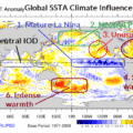
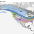
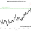
Although El Niño and La Niña events are characterized by warmer or cooler than average sea surface temperatures in the tropical Pacific, they are also associated with changes in wind, pressure, and rainfall patterns. In the tropics where El Niño and La Niña form, rainfall tends to occur over areas having the warmest sea surface temperature. La Niña is characterized by unusually cool ocean surface temperatures in the central and eastern tropical Pacific. It is the opposite of El Niño, which is marked by unusually warm ocean surface temperatures. Both are strongly coupled to the atmospheric circulation in the tropics and are major – but not the only – determinants of the seasonal and year-to-year fluctuations of our climate. Thus, these events also impact the number of tropical cyclones which develop over the Atlantic with fewer storms forming during El Nino years and above-normal hurricane activity being experienced in La Nina situations. The present La Niña follows closely behind the moderate to strong La Niña that started in September 2010 and ended with neutral conditions established in May 2011, when ocean temperatures, tropical rainfall patterns, and atmospheric winds over the equatorial Pacific Ocean returned to near the longterm average. The neutral conditions subsequently gave way to a re-emergence of La Niña. By the end of October,2011 the La Niña had slowly strengthened to a weak-to-moderate level.